Imagine being able to predict which neighbourhoods are most vulnerable to urban flooding, identify deforestation before it becomes irreversible, map underground infrastructure without digging up roads, or help autonomous vehicles understand the world around them.
Now imagine building a career doing precisely that.
Welcome to the world of Geospatial Data Science and Geospatial Engineering – two rapidly evolving disciplines that combine geography, mathematics, engineering, computer science, satellite technology and artificial intelligence to help us understand, map and make decisions about our physical world.
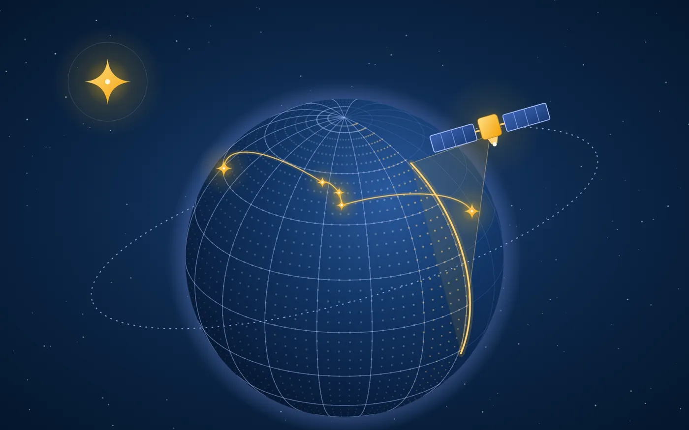
For decades, maps were primarily tools for navigation and geographical reference. Today, location has become a powerful dimension of data. Satellites generate enormous volumes of Earth observation imagery, drones capture high-resolution terrain information, sensors monitor infrastructure in real time, and AI systems extract patterns from geographical data that would otherwise remain invisible.
The result? A new generation of professionals who do not simply make maps. They build the intelligence systems that help governments, businesses and researchers understand what is happening on our planet – and what might happen next.
So, should you consider studying this field? Which academic backgrounds are suitable? Where should you study? And, most importantly, what does the career trajectory look like?
Let’s decode it.
First, What exactly is Geospatial Data Science?
Geospatial data refers to information associated with a particular location on Earth. It could be the coordinates of a building, the movement of a vehicle, satellite imagery of a forest, the depth of an ocean, or the distribution of a disease across a city.
Geospatial Data Science is the discipline that uses computational techniques, statistical methods, machine learning and geographical information systems to collect, process, analyse and interpret this information.
Think of it as conventional data science with an additional dimension: location.
A conventional data scientist might analyse the purchasing behaviour of 100,000 customers. A geospatial data scientist might investigate where those customers live, how far they travel to a store, which neighbourhoods are underserved and how the introduction of a new store could change the market.
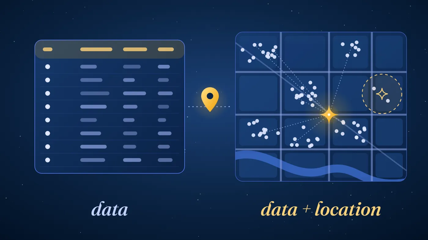
The difference is significant.
Geospatial Data Science helps answer questions that ordinary data analysis cannot fully address because geographical relationships, proximity, distance, terrain and spatial patterns matter.
What technologies power this discipline?
Some of the principal technologies include:
- Geographic Information Systems (GIS): Platforms for capturing, managing, analysing and visualising geographical information. ArcGIS and QGIS are widely used examples.
- Remote Sensing: Collecting information about the Earth using satellites, aircraft, drones and other sensors without physically interacting with the objects being studied.
- Spatial Statistics: Mathematical methods for identifying patterns, correlations and relationships across geographical locations.
- Geospatial AI (GeoAI): Applying machine learning and deep learning to geographical information, satellite imagery and spatial datasets.
- Photogrammetry: Extracting accurate measurements and three-dimensional information from photographs and aerial imagery.
- LiDAR: Using laser pulses to measure distances and create highly detailed 3D representations of terrain, buildings and other objects.
- GNSS and GPS: Satellite-based positioning technologies that determine precise geographical locations.
The discipline is increasingly supported by programming languages and frameworks such as Python, R, SQL, PostgreSQL/PostGIS, Google Earth Engine and cloud computing platforms.
In other words, it is no longer enough to know how to read a map. The modern geospatial professional needs to understand the data, the technology and the underlying science.
Geospatial Data Science vs Geospatial Engineering: What Is the Difference?
Although the two fields overlap considerably, they are not interchangeable.
A useful way to understand the distinction is to consider the difference between analysing geographical information and engineering the systems that acquire, process and deliver it.
Geospatial Data Science
- Focuses on extracting insights from geographical data
- Strong emphasis on statistics, programming and machine learning
- Works extensively with GIS, remote sensing and GeoAI
- Answers questions about spatial patterns and predictions
- Suitable for analytical and computational thinkers
Geospatial Engineering
- Focuses on acquiring, measuring, processing and engineering spatial information
- Strong emphasis on surveying, geodesy, positioning, measurement and engineering
- Works with GNSS, LiDAR, photogrammetry, surveying instruments and GIS
- Builds accurate spatial reference systems, measurement workflows and geospatial infrastructure
- Suitable for engineering-oriented and technically inclined students
For example, consider a proposed metro rail project.
A geospatial engineer might survey the proposed corridor, measure terrain elevations, map underground utilities and establish accurate geographical reference points.
A geospatial data scientist might analyse population density, traffic patterns, accessibility, land use and environmental impact to identify the most suitable route.
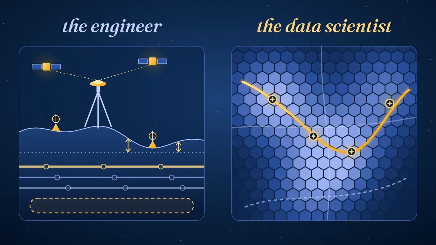
Both professionals contribute to the same project, but their responsibilities differ.
Which one should you choose?
If you enjoy mathematics, programming, statistics and extracting insights from complex datasets, Geospatial Data Science could be your natural fit.
If you enjoy physics, surveying, civil engineering, measurement systems, positioning technologies and building technical infrastructure, Geospatial Engineering deserves serious consideration.
There is considerable overlap, and the right choice ultimately depends on the curriculum and your intended career specialisation.
Who Should Study Geospatial Data Science or Geospatial Engineering?
Here is where things get interesting.
You do not necessarily need to have studied Geography to enter this field. In fact, some of the most exciting opportunities lie at the intersection of seemingly unrelated academic disciplines.
A. Computer Science and Mathematics students
If you have studied Computer Science, Mathematics, Statistics, Artificial Intelligence or Data Science, you already possess several of the foundational skills required for Geospatial Data Science.
You could specialise in:
- Geospatial machine learning.
- Satellite imagery analysis.
- Spatial data engineering.
- Location intelligence.
- GeoAI and predictive modelling.
For students interested in combining AI with real-world applications, this is one of the most exciting pathways.
B. Geography and Environmental Science students
Students with backgrounds in Geography, Environmental Science, Earth Sciences, Ecology and Geology can leverage their understanding of physical landscapes, ecosystems, climate and human geography.
They could specialise in:
- Climate risk modelling.
- Environmental monitoring.
- Disaster management.
- Land-use and land-cover analysis.
- Natural resource management.
- Remote sensing and Earth observation.
The advantage here is domain knowledge. Knowing how geographical and environmental systems behave is just as important as knowing how to process their data.
C. Civil Engineering and Architecture students
Urban infrastructure is becoming increasingly dependent on accurate spatial information.
Civil engineers, architects, urban planners and transportation professionals can transition into geospatial specialisations involving:
- Smart city development.
- Infrastructure mapping.
- Digital twins.
- Transportation modelling.
- Construction surveying.
- 3D city modelling and geodesign.
Students who enjoy combining engineering with large-scale infrastructure planning should explore this route.
D. Electrical Engineering, Electronics and Physics students
Satellite navigation, positioning systems, radar, LiDAR, remote sensing instruments and sensor networks require a strong understanding of physics and engineering.
Students from these backgrounds could explore:
- GNSS and satellite positioning.
- Sensor development.
- Photogrammetry.
- Radar remote sensing.
- Earth observation instrumentation.
- Autonomous navigation systems.
E. Economics, Public Policy and Business students
This might surprise you, but location intelligence has significant applications in business and public policy.
Consider a retailer deciding where to establish its next distribution centre, an insurance company assessing flood exposure across its property portfolio, or a government identifying regions with inadequate healthcare access.
Geospatial analytics can influence all these decisions.
Students with quantitative backgrounds in Economics, Business Analytics, Urban Planning or Public Policy may find specialised pathways into location intelligence, spatial economics, urban analytics and geospatial market research.
Where Should You Study? Universities Offering Strong Geospatial Programmes
This is arguably the most important decision for aspiring geospatial professionals.
A university’s overall global ranking does not necessarily tell you how strong its geospatial programme is. You should investigate its faculty, research centres, industry collaborations, laboratory facilities, access to satellite and Earth observation datasets, and the technical depth of its curriculum.
The following institutions are particularly worth exploring.
-
1United Kingdom
University of Glasgow
MSc Geospatial Data Science & AI
The University of Glasgow deserves particular attention because its programme directly addresses the convergence of geospatial science, artificial intelligence and machine learning.
Students develop foundations in GIS, cartography, spatial statistics and remote sensing before moving into more advanced subjects such as:
- Geospatial Artificial Intelligence.
- Machine Learning Applications for Earth Systems.
- Big Geospatial Data Analytics.
- Remote Sensing of the Environment.
- Web and Mobile Mapping.
The programme is designed to combine computational skills with real-world environmental, urban and socio-technical applications.
Why consider it?
If you are interested in becoming a GeoAI specialist, geospatial data scientist or spatial data engineer, this is one of the most directly aligned programmes to investigate.
-
2Switzerland
ETH Zurich
MSc Geomatics
When discussing geospatial engineering, ETH Zurich deserves a place on the shortlist.
Its Geomatics programme brings together several technically demanding areas:
- Geographic Information Science and Cartography.
- Geodesy and Navigation.
- Cadastral and Land Surveying.
- Engineering Geodesy and Geomonitoring.
- Remote Sensing and Photogrammetry.
Students can develop expertise in geospatial data acquisition, analysis and visualisation through a research-oriented and project-based curriculum.
ETH Zurich is particularly interesting for students who want to explore the engineering foundations of spatial technologies rather than restrict themselves to conventional GIS applications.
Why consider it?
For academically strong students interested in advanced geomatics, positioning systems, surveying, geodesy, photogrammetry and research-driven engineering, ETH Zurich is a compelling destination.
-
3Netherlands
University of Twente
MSc Geo-information Science and Earth Observation
The University of Twente’s Faculty of Geo-Information Science and Earth Observation (ITC) is a particularly relevant institution for students interested in the scientific and technological dimensions of geospatial information.
Its academic focus includes:
- Earth observation.
- Remote sensing.
- Geoinformatics.
- Spatial data analysis.
- Environmental monitoring.
- Geospatial applications for sustainable development.
The programme is particularly attractive for students interested in using satellite-derived information and spatial technologies to address global challenges.
Why consider it?
The Netherlands has a strong ecosystem in water management, environmental monitoring, geospatial technology and urban planning. Twente’s ITC faculty offers an academic environment closely connected to these areas.
-
4United States
Pennsylvania State University
MS in Spatial Data Science and Master of Geographic Information Systems
Penn State is a particularly interesting option because it offers dedicated graduate programmes in both Spatial Data Science and GIS.
Its MS in Spatial Data Science focuses on the intersection of geographical science, data science, programming, spatial analysis and visualisation.
Its Master of GIS is designed to prepare professionals to design and manage complex geographic information systems.
Students can explore subjects such as:
- Advanced Python Programming for GIS.
- Spatial Data Science.
- Geospatial Analytics.
- Remote Sensing.
- Geospatial Intelligence.
- Spatial Database Management.
- Web Mapping and GIS Development.
Penn State also offers online graduate programmes, making it worth considering for working professionals.
Why consider it?
Students who want a technically oriented education combining programming, data analytics and GIS should investigate Penn State’s dedicated geospatial portfolio.
-
5United Kingdom
University of Glasgow
MSc Geospatial & Mapping Sciences
This is a separate programme from Glasgow’s Geospatial Data Science & AI degree and deserves attention for a different reason.
Its curriculum is more engineering and surveying oriented, covering:
- Land and Engineering Surveying.
- GNSS and Geodesy.
- Hydrographic Surveying.
- Topographic Modelling.
- Geospatial Engineering.
- Land Administration.
The programme also provides exposure to technologies such as real-time kinematic GNSS and terrestrial laser scanning.
Why consider it?
Students interested in becoming land surveyors, engineering surveyors, hydrographic specialists or geospatial engineering professionals should examine this programme closely.
-
6India
Indian Institute of Remote Sensing (IIRS), ISRO
MSc Geo-information Science and Earth Observation (Specialisation: Geoinformatics)
Indian students should not overlook this opportunity.
The Indian Institute of Remote Sensing, operating under ISRO, offers a joint education programme with the University of Twente’s ITC faculty.
The two-year programme is structured across IIRS in India and the ITC faculty in the Netherlands. Students undertake the first year at IIRS, followed by research and further academic work at ITC.
The programme covers subjects such as:
- Scientific Geocomputing.
- Acquisition and Exploration of Geospatial Data.
- Extraction and Analysis of Geospatial Information.
- Geoinformatics.
- Earth Observation and Remote Sensing.
Successful students receive the MSc degree in Geo-Information Science and Earth Observation from the University of Twente.
Why consider it?
For Indian students seeking specialised education in geoinformatics and Earth observation, this is an especially interesting pathway because of its connection to India’s space research ecosystem and an established international geospatial faculty.
What Will You Actually Learn During the Course?
While programme structures differ, a serious postgraduate programme in this discipline should expose students to a combination of theoretical knowledge, computational techniques and practical applications.
Here are some subjects worth looking for when evaluating a university curriculum.
| Subject | What you learn |
|---|---|
| Geographic Information Systems | Managing and analysing geographical datasets |
| Remote Sensing | Extracting information from satellite and aerial imagery |
| Spatial Statistics | Identifying geographical patterns and relationships |
| Geospatial Programming | Using Python, R and SQL for spatial analysis |
| Photogrammetry | Reconstructing terrain and objects using images |
| Geodesy | Understanding Earth’s shape, gravity and reference systems |
| Machine Learning | Developing predictive models using spatial datasets |
| GeoAI | Applying AI and deep learning to geographical problems |
| Cartography and Visualisation | Communicating spatial information effectively |
| Spatial Database Management | Building and managing geospatial data infrastructures |
A strong programme should ideally include a substantial research project, dissertation, industry collaboration or capstone.
Do not underestimate this component.
Employers want candidates who can demonstrate that they have actually solved a geospatial problem, not simply completed a series of theoretical modules.
Career Opportunities: Where can a Geospatial Degree Take You?
Here is where the discipline becomes particularly exciting.
Geospatial professionals are increasingly relevant across industries that traditionally had very little to do with mapping.
A. Climate Science and Environmental Intelligence
Climate change has made the ability to monitor and predict environmental changes increasingly important.
Geospatial professionals help organisations monitor:
- Deforestation and biodiversity loss.
- Coastal erosion and rising sea levels.
- Flood vulnerability.
- Agricultural productivity.
- Forest fires and land degradation.
- Climate-related infrastructure risks.
Potential Roles: Climate Risk Analyst, Environmental Data Scientist, Remote Sensing Analyst, Earth Observation Specialist.
B. Urban Planning and Smart Cities
Cities generate enormous amounts of spatial information.
Geospatial specialists help planners understand population movement, infrastructure gaps, transportation networks, land use and urban expansion.
They can contribute to designing more efficient cities and improving public services.
Potential Roles: Urban Data Analyst, GIS Consultant, Spatial Planning Specialist, Smart City Consultant.
C. Defence, Intelligence and National Security
Geospatial intelligence, commonly referred to as GEOINT, involves analysing geographical information to support strategic and operational decision-making.
Satellite imagery, terrain analysis, movement patterns and remote sensing can provide valuable intelligence for national security and disaster response.
Potential Roles: Geospatial Intelligence Analyst, Imagery Analyst, Remote Sensing Specialist, Defence Technology Researcher.
Some roles in this sector may require security clearances, citizenship or other government-specific eligibility.
D. Autonomous Vehicles and Robotics
Autonomous vehicles need to understand their surroundings, determine their location and navigate complex environments.
This requires technologies such as LiDAR, high-definition mapping, GNSS, computer vision and spatial data processing.
Geospatial engineers and data scientists contribute to the systems that enable machines to interpret physical environments.
Potential Roles: Mapping Engineer, Robotics Mapping Specialist, Autonomous Navigation Engineer, Computer Vision Engineer.
E. Insurance, Banking and Financial Services
Location is an increasingly important variable in financial risk assessment.
Insurance companies use geospatial information to evaluate flood exposure, wildfire risk and property vulnerability. Banks and financial institutions can use location intelligence to understand asset concentration, regional exposure and market opportunities.
Potential Roles: Geospatial Risk Analyst, Location Intelligence Analyst, Climate Risk Modeller, Spatial Analytics Consultant.
F. Agriculture, Energy and Infrastructure
Precision agriculture, renewable energy development, mineral exploration and utility management all depend on accurate spatial information.
Professionals in this area may work with drone imagery, satellite data, terrain models and geographical databases.
Potential Roles: GIS Specialist, Geospatial Engineer, Remote Sensing Scientist, Infrastructure Mapping Engineer.
The AI Factor: Why GeoAI Could Change the Industry
If there is one emerging specialisation students should pay particular attention to, it is Geospatial Artificial Intelligence, or GeoAI.
Traditional geospatial workflows often required specialists to manually process imagery, classify geographical features and identify patterns across large datasets.
AI is changing the nature and scale of these operations.
Consider a satellite image covering thousands of square kilometres.
A machine learning model can help identify buildings, roads, agricultural fields, water bodies and changes in forest cover. Deep learning techniques can also assist in identifying geographical features, detecting anomalies and monitoring changes over time.
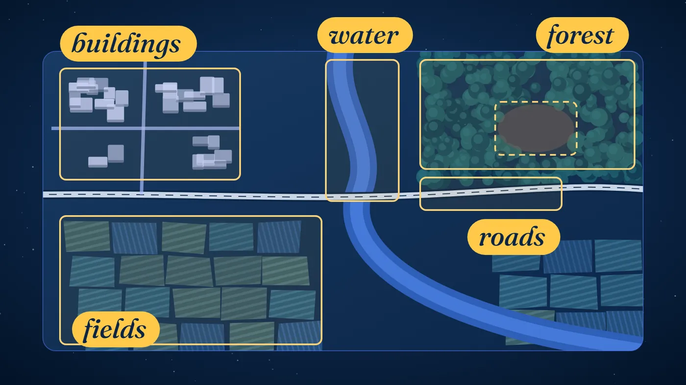
Now imagine combining this with real-time sensor data, weather information, historical geographical records and predictive modelling.
The possibilities extend to:
- Predicting flood prone areas.
- Identifying illegal deforestation.
- Monitoring urban expansion.
- Estimating crop yields.
- Detecting infrastructure damage.
- Mapping disaster-affected regions.
- Modelling climate and environmental risks.
However, AI does not eliminate the need for geospatial expertise.
Geographical data has unique challenges involving spatial resolution, coordinate reference systems, data quality, scale, uncertainty and geographical context. A model that produces an impressive prediction can still be fundamentally wrong if the underlying spatial assumptions are incorrect.
This is precisely why professionals who understand both geospatial science and AI could become increasingly valuable.
What Does the Career Trajectory Look Like?
A geospatial career does not have to begin and end with a GIS Analyst position.
With the right combination of technical skills, domain expertise and professional experience, students can build careers across analytical, engineering, research and leadership tracks.
A possible career progression:
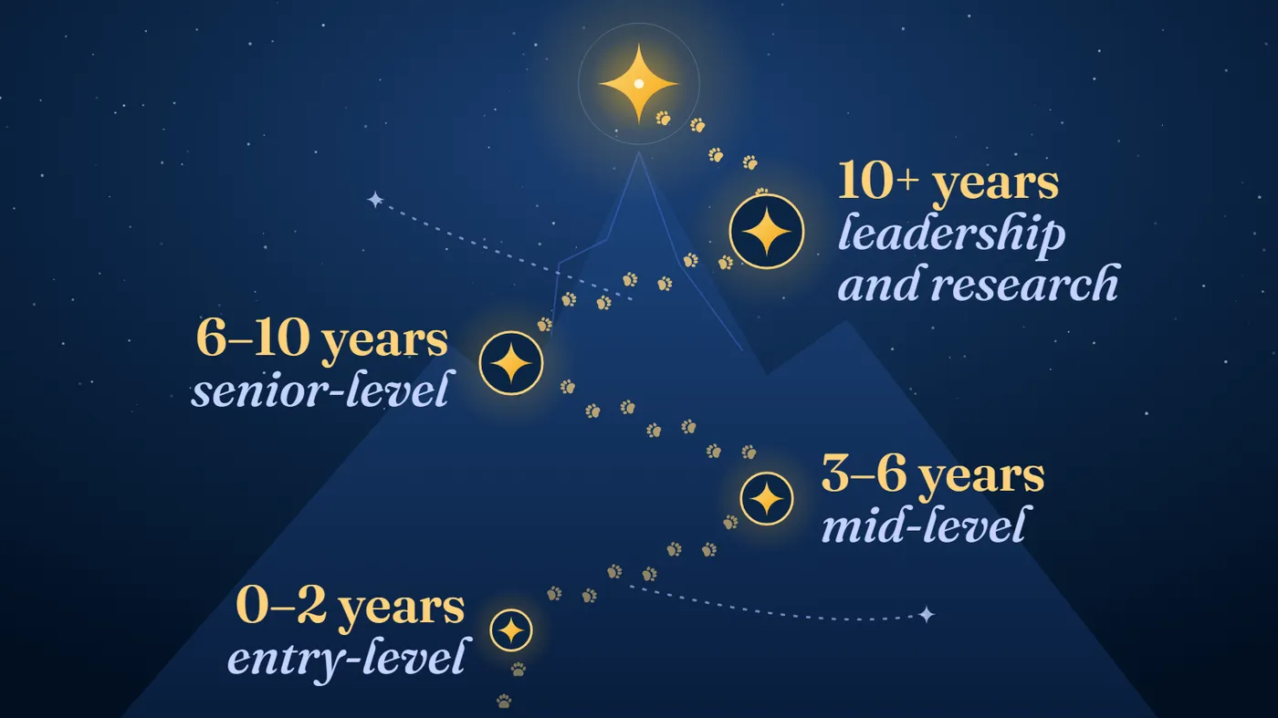
Entry-level (0–2 years)
- Junior GIS Analyst.
- Remote Sensing Analyst.
- Geospatial Data Analyst.
- Surveying or Mapping Engineer.
- Spatial Data Technician.
Mid-level (3–6 years)
- Geospatial Data Scientist.
- GIS Developer.
- Geospatial Engineer.
- Earth Observation Specialist.
- Spatial Analytics Consultant.
Senior-level (6–10 years)
- Senior Geospatial Data Scientist.
- Geospatial Solutions Architect.
- GeoAI Specialist.
- Geospatial Project Manager.
- Technical Lead – Earth Observation.
Leadership and Research (10+ years)
- Director of Geospatial Analytics.
- Head of Geospatial Engineering.
- Chief Geospatial Officer.
- Geospatial Technology Consultant.
- Research Scientist or Academic.
Students interested in research can also pursue doctoral studies in remote sensing, geoinformatics, geomatics, spatial statistics, Earth observation or GeoAI.
What Skills Should You Develop Before Applying?
A postgraduate degree will provide the academic foundation, but students who begin building technical proficiency before enrolment can gain a meaningful advantage.
Here is a practical preparation roadmap.
0 of 7
A few portfolio ideas:
- Map urban expansion in a rapidly growing Indian city using satellite imagery.
- Develop a flood vulnerability model for a district.
- Analyse changes in forest cover over a decade.
- Create a location intelligence dashboard for healthcare accessibility.
- Use satellite imagery to classify agricultural land.
These projects can help demonstrate both technical competence and the ability to translate data into actionable insights.
Is This the Right Career for You?
Let’s be clear: Geospatial Data Science and Geospatial Engineering are not simply fashionable alternatives to conventional Computer Science or Data Science degrees.
They are specialised disciplines requiring genuine interest in the physical world, geographical systems, quantitative analysis and technology.
You may enjoy this field if:
0 of 5
On the other hand, if your primary interest is software development with no inclination towards spatial problems, a conventional Computer Science or AI degree may provide a broader and more direct route.
The choice should be driven by your interests and long-term career objectives, not simply by the novelty of the subject.
The Blue Bear Verdict: The Future is not Just Digital. It is Spatial.
For years, students have been encouraged to explore careers in Artificial Intelligence, Data Science, Cybersecurity and Cloud Computing. Those fields remain important, but another technological frontier is emerging – one that connects digital intelligence to the physical world.
Geospatial Data Science and Engineering sit right at that intersection.
The next generation of climate models, smart cities, autonomous navigation systems, disaster response technologies and infrastructure planning tools will depend on our ability to understand geographical information at an unprecedented scale.
And that requires professionals who can think like scientists, code like engineers and interpret the world through the lens of spatial intelligence.
For an aspiring student, the opportunity is not merely to learn how to map the world.
It is to develop the skills to understand it, predict its changes and help shape what comes next.
Big dreams. Bigger world. And an entirely new world of opportunities waiting to be mapped!
Frequently asked questions
What is the difference between geospatial data science and geospatial engineering?
Geospatial data science is about finding insights in location data, using statistics, programming and machine learning. Geospatial engineering is about measuring the world and building the systems that collect and deliver that data, with surveying, geodesy, GNSS and LiDAR. The two overlap a lot, and big projects often need both.
Do I need a geography degree to study geospatial data science?
No. Students come from computer science, maths, environmental science, civil engineering, architecture, physics and even economics or public policy. What matters is meeting each programme’s own requirements: engineering programmes may ask for maths or physics, and data science programmes for programming.
Which universities offer strong geospatial programmes?
This guide looks at six programmes: two at the University of Glasgow, and one each at ETH Zurich, the University of Twente’s ITC faculty, Penn State and the Indian Institute of Remote Sensing. Rankings alone won’t tell you much, so look at the faculty, the labs, links with industry, access to satellite data and the depth of the curriculum.
Can I study geospatial science in India?
Yes. The Indian Institute of Remote Sensing (IIRS), part of ISRO, runs a two-year joint MSc with the University of Twente’s ITC faculty, with a specialisation in geoinformatics. Students start at IIRS in India and spend part of the course at ITC in the Netherlands, and the degree comes from the University of Twente.
What jobs can I get with a geospatial degree?
Early roles include GIS analyst, remote sensing analyst and spatial data technician. With experience, people become geospatial data scientists, geospatial engineers, GeoAI specialists and, later, leaders or researchers. The work spans climate and environment, cities, defence, autonomous vehicles, insurance and banking, and agriculture and energy. If you’d like help choosing a programme, talk to us.
Will AI replace geospatial experts?
Not according to this guide. AI can quickly find buildings, roads or lost forest in satellite images, but location data has its own problems, such as scale, coordinate systems and uncertainty. A model can still be badly wrong if its spatial assumptions are wrong, which is why people who understand both geospatial science and AI could become more valuable.